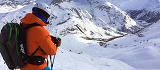
Antagnod Ski Resort Guide
Antagnod, Italy
Rated: 2/5 (from 6 ratings) Write a Review
| Recommended For | Intermediates, Snowboarders and Snowfall. |
|---|---|
| Total Piste Length | 14km 9 miles |
| Highest Lift | 2,310m 7,579ft |
| Resort Height | 1,700m 5,577ft |
| Nearest Airports | Turin Caselle and Milan Malpensa |
Antagnod
Antagnod is a hidden gem nestled in the Aosta Valley. It offers a picturesque blend of skiing and authentic alpine culture.
Summary
Antagnod provides a charming skiing experience with gentle slopes perfect for families and beginners. Its scenic backdrop and cozy village atmosphere make it a delightful retreat.
The ski area of Antagnod is in the Italian Alps at an altitude of 1,700m 5,577ft , with 14km 9 miles of marked runs.
Antagnod is part of the Monterosa ski area with access to 64 marked pistes, served by a total of 52 ski lifts. In addition to the skiing in Antagnod itself ( 14km 9 miles of pisted ski runs), the appropriate ski Lift Pass will allow you to ski or snowboard in the other Monterosa ski resorts of Alagna Valsesia, Brusson, Champoluc, Champorcher, Gressoney Saint Jean and Gressoney la Trinité.
The ski resort itself is at 1,700m 5,577ft , so skiing or boarding back to the resort is usually possible. With ski lifts as high as 2,310m 7,579ft , snow cover is generally reliable.
Notable Ski Runs
The longest possible descent in Antagnod is 7km 4 miles long and the most difficult run is the 'Vascoccia', which is 5km 3 miles in length.
Snow and Weather
Antagnod enjoys good snow reliability, with average snowfall reaching up to 3 meters during the season. Snow depths can vary, so check J2Ski for the latest snow reports to plan your visit.
When will it snow in Antagnod?
There is currently no significant snow in the 7-day forecast for Antagnod.
See our long-range Snow Forecast for the latest update.
Snow this week
| We | Th | Fr | Sa | Su | Mo | Tu |
|---|---|---|---|---|---|---|
Ski Area Stats
Antagnod Ski Area
| Black Pistes Expert Trails | 1 | |
|---|---|---|
| Red Pistes Intermediate Runs | 1 | 5km 3 miles |
| Blue Pistes Easy Trails | 4 | 13km 8 miles |
| Downhill Total Length | 14km 9 miles | |
| Cross Country Total Length | 32km 20 miles | |
| Ski Lifts Number of Lifts | 7 | |
Monterosa Ski Area
| Black Pistes Expert Trails | 5 | |
|---|---|---|
| Red Pistes Intermediate Runs | 37 | |
| Blue Pistes Easy Trails | 14 | |
| Green Pistes Beginner Runs | 8 | |
| Ski Lifts Number of Lifts | 52 | |
Antagnod Altitudes
| Highest Lift | 2,310m 7,579ft |
|---|---|
| Lowest Piste | 1,730m 5,676ft |
| Resort Altitude (Antagnod) | 1,700m 5,577ft |
| Max Vertical | 610m 2,001ft |
Ratings & Suitability
| Intermediate Skiers | |
|---|---|
| Beginners | |
| Snowboarding | |
| Snow | |
| Apres-Ski |
Skiing
The resort is set on the slopes of Monte Zerbion, offering around 26 km of pistes that cater to various skill levels. Notable ski areas include the well-connected Antagnod and the nearby Champoluc, with key lifts like the Piussogno and the Crest chairlifts enhancing access to the terrain.
Antagnod offers good sking, particularly, for Intermediate skiers.
Ski Lessons in Antagnod
To choose a Ski School, and book Group Ski Lessons or a Private Instructor, see Antagnod Ski Schools and Antagnod Ski Instructors.
Snowboarding
Snowboarders will find ample opportunities at Antagnod, particularly in the terrain parks located in the nearby Champoluc area. The parks are well-maintained and offer features suitable for all skill levels.
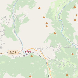
Location and Map
Where is Antagnod?
This ski resort is in the Italian Alps in Ayas, Valle d'Aosta.
Map
Tap ![]() for Full-Screen, or see J2Ski's Resort map, showing Hotels and Ski Shops.
for Full-Screen, or see J2Ski's Resort map, showing Hotels and Ski Shops.
How to get there
By Air
The nearest airport to Antagnod is Turin Caselle, 84 minutes drive away.
Milan Malpensa, Milan Linate, Turin Cuneo, Sion, Genoa, Geneva, Bergamo, Lugano and Annecy airports are all within three hours drive.
Antagnod is easily accessible via the A5 motorway, with the nearest major airport being Turin International Airport, approximately 100 km away. Regular shuttle services connect the airport to the resort, making travel convenient.
Infrastructure
Ski Lift Capacity
The seven ski lifts are able to uplift 5,900 skiers and snowboarders every hour.
Snow Making
Snow-making is available, on 13km 8 miles of ski runs, with 10 snow cannons.
Season Dates
When is Antagnod open?
We don't currently have confirmed season dates, but hope to soon.
Usual opening is late November (Opens when snow cover adequate in late Nov or early Dec), and usual closing is Late April.
NOTE:- Ski area, lift and piste opening is subject to Current Snow Conditions.
Aprés Ski
After a day on the slopes, unwind at the local bars such as Bar La Vigne or enjoy a meal at Ristorante La Grange. The vibrant atmosphere and friendly locals make for a delightful après-ski experience.